

PROJECTS
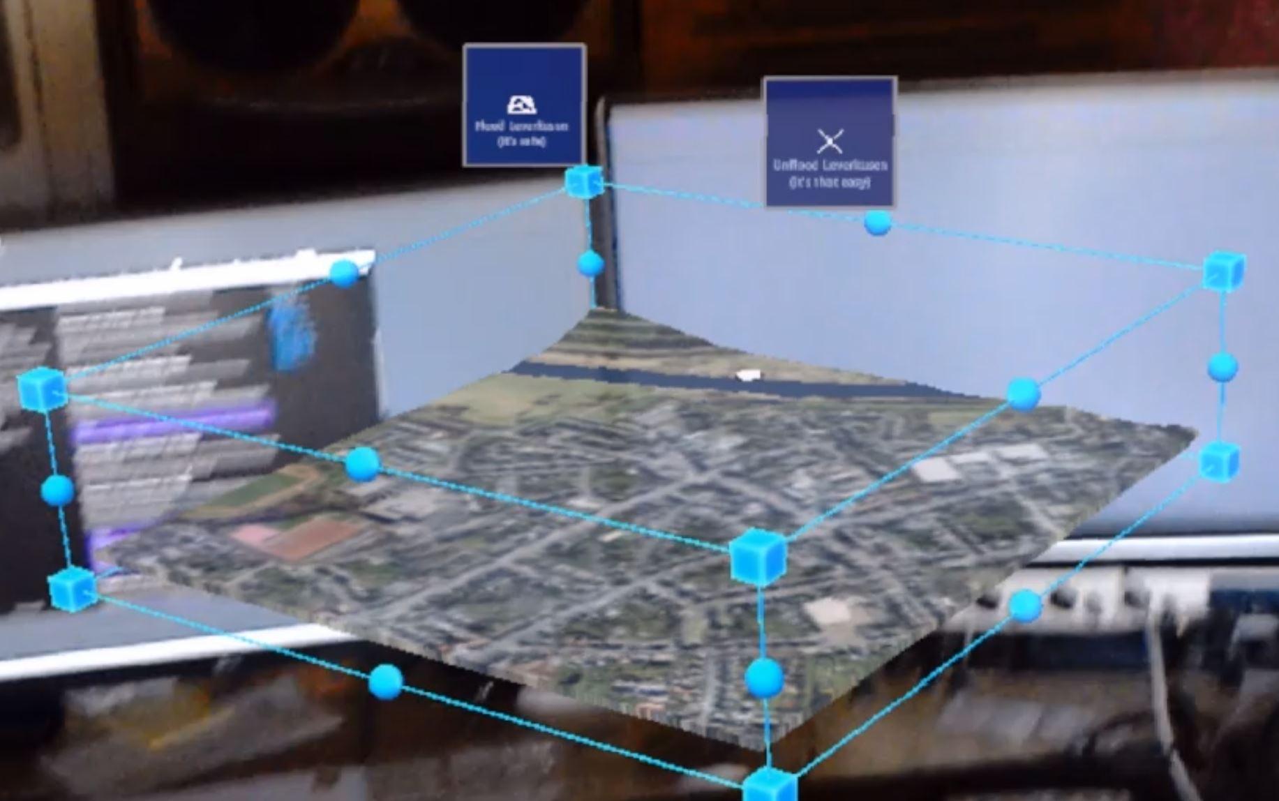
Photo: D. Schornsheim
oKat-SIM
oKat-SIM is developing the idea of using Augmented Reality (AR) in professional training for disaster control and civil security, with the aim of providing technical and methodological training for managers in administration and state authorities for crisis situations.
https://www.uni-potsdam.de/okat-sim/
https://www.uni-potsdam.de/okat-sim/
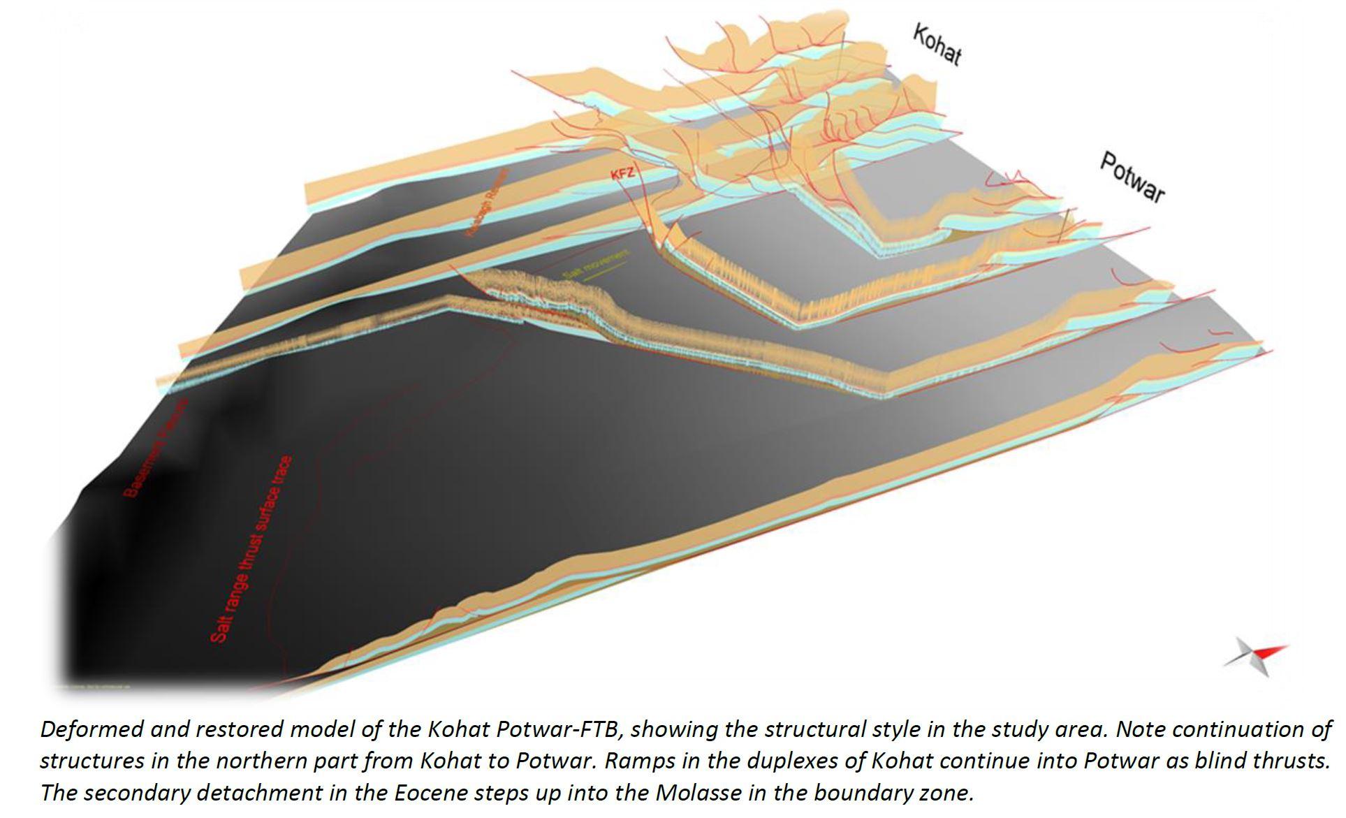
Photo: H. Ghani
Structures in Pakistan
Visually analyzed structures and their internal relationships are valuable in understanding structural style transitions in orogenic belts. In this project, 3D structural models are proposed and discussed to explain the structural variations, the responsible factors for the structural variations, and the evolution of structures within the fold and overthrust belt of the Himalayas.
Ghani et al. (2018). Structural variation within the Himalayan fold and thrust belt: A case study from the Kohat-Potwar Fold Thrust Belt of Pakistan. Journal of Structural Geology, 116, 34-46, DOI: 10.1016/j.jsg.2018.07.022
Ghani et al. (2018). Structural variation within the Himalayan fold and thrust belt: A case study from the Kohat-Potwar Fold Thrust Belt of Pakistan. Journal of Structural Geology, 116, 34-46, DOI: 10.1016/j.jsg.2018.07.022

Photo: A. Walz
GeoSimulator
The GEOSimulator is an interdisciplinary teaching project that was offered to graduate students in Geoecology, Geosciences and Geoinformation & Visualization. The project tested 3D geovisualization and its utility in research-based learning on flood risk. Immersive 3D visualization, including immersive 3D geovisualization, is not only an important tool for businesses, but indeed also for higher education: the 3D CAVE showcased an inspiring and supportive learning environment, which suggests an increased effectiveness for learning.
Philips et al. (2015). Immersive 3D geovisualization in higher education. Journal of Geography in Higher Education, 39(3), 437-449, DOI: 10.1080/03098265.2015.1066314
Philips et al. (2015). Immersive 3D geovisualization in higher education. Journal of Geography in Higher Education, 39(3), 437-449, DOI: 10.1080/03098265.2015.1066314

Photo: N. Rhode
GIS Teaching
Three-dimensional visualization has been improved and used to analyze complex structures in the geosciences field. 3D CAVE (Computer-Animated Virtual Environment) provides a modern visualization environment for analyzing complex spatial and temporal multiscale datasets. CAVE provides an interactive learning environment for students as well as the possibility of discussing and manipulating models during discussions with peers.
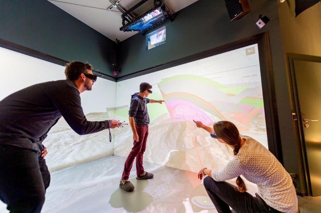
Photo: T. Hopfgarten
Structural Geology Andes
Deformations in the central Andes are associated with the subduction of the Nazca plate beneath the South American continent. Detailed structural mapping in combination with three-dimensional analyses of subsurface sedimentary basins and reactivation patterns of faults were applied to analyze the complex deformation structures and exhumation event in the Tonco area in the Andes.
Payrola et al. (2020). Episodic out-of-sequence deformation promoted by Cenozoic fault reactivation in NW Argentina. Tectonophysics, 776, 228276, DOI: 10.1016/j.tecto.2019.228276
Payrola et al. (2020). Episodic out-of-sequence deformation promoted by Cenozoic fault reactivation in NW Argentina. Tectonophysics, 776, 228276, DOI: 10.1016/j.tecto.2019.228276
Photo: X. Hadeen
Deformational structures in Bolivia
The South Bolivian Subands and Salar de Uyuni are tectonically highly active regions that provide a great opportunity to decipher the deformation of the interior of the Andean Plateau at large scale.
3D models were developed using the Move structural modeling suite to quantify the extent of the deformation and shortening of the Bolivian Subandes.
Salar de Uyuni project focused on the geomorphological mapping of lacustrine terraces and investigated large-wavelength vertical deformational structures in the Altiplano using high-resolution DEMs from the TanDEM-X mission.
Hadeen, X. B. (2015). Deformation in the Bolivian Subandes: a reconstruction of geologic structures along two transects across the Andean Front in Southern Bolivia. Master thesis, Institute of Geosciences, University of Potsdam.
Lee, E. (2019). Large wavelength deformation in the Andean plateau interpreted from TanDEM-X data derived shorelines of the Salar de Uyuni (Bolivia). Master thesis, Institute of Geosciences, University of Potsdam.